
The Complete Guide to the WW1 Battlefields of Flanders Fields
↓ Plan a private battlefield visit
Flanders Fields is not one single battlefield. It is a landscape of villages, ridges, canals, cemeteries, memorials and former trench lines centred on Ypres, known today by its Dutch name Ieper. Between 1914 and 1918 this relatively small part of West Flanders became one of the most continuously contested sectors of the Western Front. If you want to understand it properly, the key is not to race from monument to monument. It is to understand the shape of the Ypres Salient, why the high ground mattered, how the fighting changed over four years, and why the dead are remembered in so many different ways.
This guide is designed as a first orientation for visitors. It explains what happened, what you can still see, how the major sites relate to one another and how to plan a day that feels coherent rather than crowded. It also helps answer a question that many visitors only ask once they arrive: why does a peaceful landscape of fields and farmhouses contain such an extraordinary concentration of cemeteries and memorials?
Flanders Fields at a glance
- Main centre: Ypres/Ieper in West Flanders, Belgium.
- Core battlefield: the Ypres Salient, an exposed bulge in the Allied front line.
- Major campaigns: First Ypres in 1914, Second Ypres in 1915, Messines and Third Ypres/Passchendaele in 1917, and the German offensives and Allied advance of 1918.
- Essential sites: Menin Gate, Tyne Cot, Hill 60, Passchendaele, Polygon Wood, Essex Farm and at least one preserved trench or bunker position.
- Best first visit: one full day for the Ypres Salient. Add separate days for the Somme, Vimy Ridge or other Northern France sectors.
Planning a visit?
See the Ypres Salient as one connected battlefield
A full day gives enough time to connect Tyne Cot, Passchendaele, Hill 60, the Menin Gate and the surrounding landscape without rushing between monuments.
Explore the Full Day Flanders Fields Tour
Private tour · Up to 6 guests · Pickup from Bruges or Ypres
What does “Flanders Fields” actually mean?
The phrase is now used loosely for the First World War battlefields of Belgian Flanders, but it became internationally famous through Canadian doctor and artillery officer John McCrae’s poem In Flanders Fields, written during the Second Battle of Ypres in May 1915. McCrae was serving near the Yser Canal north of Ypres when his friend Lieutenant Alexis Helmer was killed. The poem’s image of poppies growing among graves helped turn the flower into one of the most recognisable symbols of remembrance.
Historically, however, a visitor needs a more precise map in mind. Ypres itself sat inside a forward bulge in the Allied line. German positions wrapped around the town from the north-east, east and south-east. The British called this exposed shape the Ypres Salient. It was tactically awkward because German forces occupied much of the higher ground around it. That meant German observers could often look down into Allied positions and direct artillery fire onto roads, tracks, gun batteries and reserve areas.
Today the distances seem small. Tyne Cot is only a short drive from Ypres. Hill 60 lies only a few kilometres south-east of the town. Polygon Wood, Hooge, Zonnebeke and Passendale are all close enough to link in one day. During the war those kilometres were divided by trenches, belts of wire, artillery zones and ground swept by machine-gun fire. A ridge that looks insignificant from a modern road could decide whether one side could observe the other.
Why Ypres mattered from the beginning
Ypres was important because of geography. In 1914 German armies invaded Belgium as part of their attempt to defeat France quickly. After the failure of the initial German advance and the Allied counter-offensive on the Marne, both sides tried to outflank one another to the north in what became known as the “Race to the Sea”. The fighting eventually reached Flanders. Ypres stood on routes leading towards the Channel ports of Dunkirk and Calais, which were crucial for British supply and communications.
By autumn 1914 the line around Ypres hardened. The First Battle of Ypres was not a single neat engagement but a sequence of desperate actions in October and November. Regular soldiers of the pre-war British Army, French formations, Belgian forces and German troops fought across the approaches to the town. The fighting helped prevent a German breakthrough to the Channel ports, but it also fixed the basic shape of a front line that would continue to dominate the region.
The pre-war British Expeditionary Force suffered enormous losses. Later memory often described the destruction of the “Old Contemptibles”, the professional army that had crossed to France in August 1914. That phrase can oversimplify what happened, because formations continued to serve and reinforcements arrived, but the scale of casualties fundamentally changed the character of the British Army. The battlefield around Ypres became a place where the small professional force of 1914 gave way to the much larger citizen armies of the later war.
Understanding the Salient: the most useful piece of battlefield geography
If you understand the Salient, most of the major Ypres sites suddenly make more sense. Imagine Ypres at the centre of a shallow bowl. To the east and south-east are ridges and low rises such as the Menin Road Ridge, Polygon Wood, Broodseinde and Passchendaele. To the south are the Messines-Wytschaete heights. North-east lie Langemark and Pilckem. None of these elevations are dramatic by Alpine standards. In Flanders, a few dozen metres of height can transform observation.
Artillery was the dominant killer of the First World War. Observation therefore mattered. A position that allowed an observer to see roads or gun flashes could bring accurate artillery fire onto the enemy. This explains why places such as Hill 60, the Butte at Polygon Wood and the Passchendaele ridge mattered out of proportion to their modest appearance today.
The Salient also created a logistical problem. Men, ammunition, food, engineering stores and artillery all had to move forward through a zone visible or reachable by German guns. Routes from Ypres towards the Menin Road, Zonnebeke and the canal became lifelines. The city itself was repeatedly shelled and eventually reduced to ruins. Modern Ypres is not a medieval town that somehow survived the war intact. Its great buildings, including the Cloth Hall, were painstakingly reconstructed after 1918.
1915: gas warfare changes the battlefield
The Second Battle of Ypres began on 22 April 1915 with an event that permanently changed the Western Front. German forces released a large cloud of chlorine gas north of Ypres against French colonial troops. The cloud caused panic, suffocation and a sudden gap in the Allied line. Canadian troops on the flank were forced into hurried defensive actions and counter-attacks to stop the crisis from becoming a complete collapse of the Salient.
The battle continued for weeks. Fighting at Kitcheners’ Wood, St Julien, Frezenberg and Bellewaarde cost tens of thousands of casualties. Gas was used again. The Allied line contracted closer to Ypres, leaving the town even more exposed. For Canadian visitors this campaign is particularly important because it helped establish the reputation of the 1st Canadian Division in one of its first major battles on the Western Front.
Two places allow you to connect this history to the ground especially well. Essex Farm preserves the setting of an Advanced Dressing Station beside the canal and is associated with McCrae. The Second Battle of Ypres guide explains the gas attack and the wider battle in more depth. Langemark German Military Cemetery lies close to the northern sector and provides a very different style of remembrance from Commonwealth cemeteries.
1916: the Salient remains dangerous even without a major Ypres offensive
Visitors sometimes jump from 1915 straight to Passchendaele in 1917. That leaves out an important truth: the Salient remained lethal even when the main strategic focus moved elsewhere. Artillery fire, trench raids, sniping and mining continued every day. In June 1916 Canadian troops fought a major local battle around Mount Sorrel, Hill 62 and Sanctuary Wood. Positions could change hands for reasons that make little sense until you see how observation worked.
Underground warfare was particularly intense in the southern Salient. Skilled miners dug galleries beneath enemy positions. Listening devices were used to detect counter-mining. Charges could destroy a trench without requiring infantry to cross open ground first. Hill 60 is one of the best places to see the physical result of that war below the surface. The irregular ground and mine craters make the site feel completely different from a formal cemetery.
Messines 1917: preparing the way for the great offensive
Before the main Flanders offensive of 1917, British forces attacked the Messines Ridge south of Ypres. General Herbert Plumer’s Second Army had spent months preparing mines beneath German positions. In the early hours of 7 June 1917, 19 mines were detonated beneath the ridge. The explosions were followed by infantry attacks supported by carefully organised artillery.
The capture of Messines improved the British position south of Ypres and removed German observation from a dominant ridge. It is often described as one of the best-planned British operations of the war. Yet even here success came at a price, and the battle did not solve the larger problem of breaking out of the Ypres area. That task was attempted later in the summer.
Third Ypres and Passchendaele: why the mud became part of the story
The Third Battle of Ypres opened on 31 July 1917. The strategic objectives were broader than simply capturing the village of Passchendaele. British leaders hoped to break through the German defensive system in Flanders, pressure German submarine bases on the Belgian coast and improve the Allied position. The campaign became a sequence of battles rather than one continuous advance.
Early progress was followed by rain. The problem was not just “bad weather”. Years of shelling had damaged the drainage system of low-lying farmland. Heavy artillery churned the surface and smashed ditches and culverts. When rain fell, water had nowhere to go. Men, horses and vehicles struggled through a landscape of flooded shell holes and shattered roads. Moving artillery forward became difficult. Carrying ammunition and food became exhausting. Evacuating a wounded man could require teams of stretcher-bearers working for hours.
In September, Plumer adopted a method of limited advances behind powerful artillery support. The Battle of the Menin Road, Polygon Wood and Broodseinde produced important gains. Australian divisions played a major role. At Broodseinde on 4 October, Australian troops captured German positions on the ridge where Tyne Cot now stands.
Conditions then deteriorated. Poelcappelle on 9 October and the First Battle of Passchendaele on 12 October became symbols of the campaign’s terrible cost. New Zealand forces suffered their deadliest day in military history on 12 October. Australian units were also badly hit. Later, the Canadian Corps was brought forward. After carefully prepared attacks in late October and early November, Canadian troops finally took the ruined village of Passchendaele on 6 November.
The name “Passchendaele” survives because it captures several things at once: tactical persistence, appalling physical conditions, immense casualties and the gap between the modest ground gained and the human price paid. A visit works best when you see more than one location. Polygon Wood shows one of the more successful phases. Tyne Cot shows the ridge and the scale of loss. The village of Passendale helps you understand the final objective. Together they tell a more accurate story than mud alone.
1918: the ground changes hands again
One of the most important corrections to the simplified Passchendaele story is that the battlefield did not remain securely in Allied hands. During the German Spring Offensives of 1918 the Ypres position was compressed and some ground won in 1917 was abandoned. The strategic situation had changed dramatically after Russia left the war, allowing Germany to move divisions west before American manpower could arrive in full strength.
Later in 1918 the balance shifted again. Allied forces advanced as the German army weakened. Belgian, British, French and Commonwealth troops pushed eastward. Passchendaele was retaken, and the war moved away from the Salient that had dominated British memory for four years.
Menin Gate: understanding a memorial to people without known graves
The Menin Gate is often the first memorial visitors recognise. It stands on the eastern side of Ypres where troops moved towards the battlefields. The current Commonwealth War Graves Commission figure is 54,348 names commemorated there. These are men whose graves were not known and whose names were assigned to this memorial after the war.
That distinction matters. A memorial to the missing is not a cemetery. The names may represent men whose remains were never found, remains that could not be identified, or soldiers buried in graves later destroyed or lost. Many unidentified bodies do lie in CWGC cemeteries. A headstone marked “Known unto God” may therefore contain one of the men named on a memorial elsewhere.
Every evening at 8pm, the Last Post Ceremony takes place beneath the memorial. The local Last Post Association began the tradition in 1928. After its first season, it resumed in May 1929 and became a daily act of remembrance, interrupted in Ypres during the German occupation of 1940–1944. The ceremony returned on 6 September 1944, the day the city was liberated. It remains free to attend.
Tyne Cot: cemetery, battlefield and memorial in one place
Tyne Cot Cemetery is the largest CWGC cemetery in the world. The current CWGC visitor material gives 11,968 graves. Behind the cemetery, the Tyne Cot Memorial carries 34,936 names. The numbers are enormous, but the site becomes much more meaningful when you understand how it began.
German concrete blockhouses defended this ridge in 1917. Australian troops captured the position during the Battle of Broodseinde on 4 October. One large blockhouse became an aid post. Men who died of their wounds were buried nearby. Those wartime graves became the nucleus of the later cemetery. After the Armistice, battlefield clearance brought thousands more remains into Tyne Cot from surrounding ground and smaller burial sites.
Look carefully at the oldest part of the cemetery and the rows become less regular. Then look at how many headstones have no identified name. CWGC material notes that roughly seven out of ten graves contain unidentified servicemen. That visual fact explains memorials to the missing better than any statistic can.
How to read a Commonwealth war cemetery
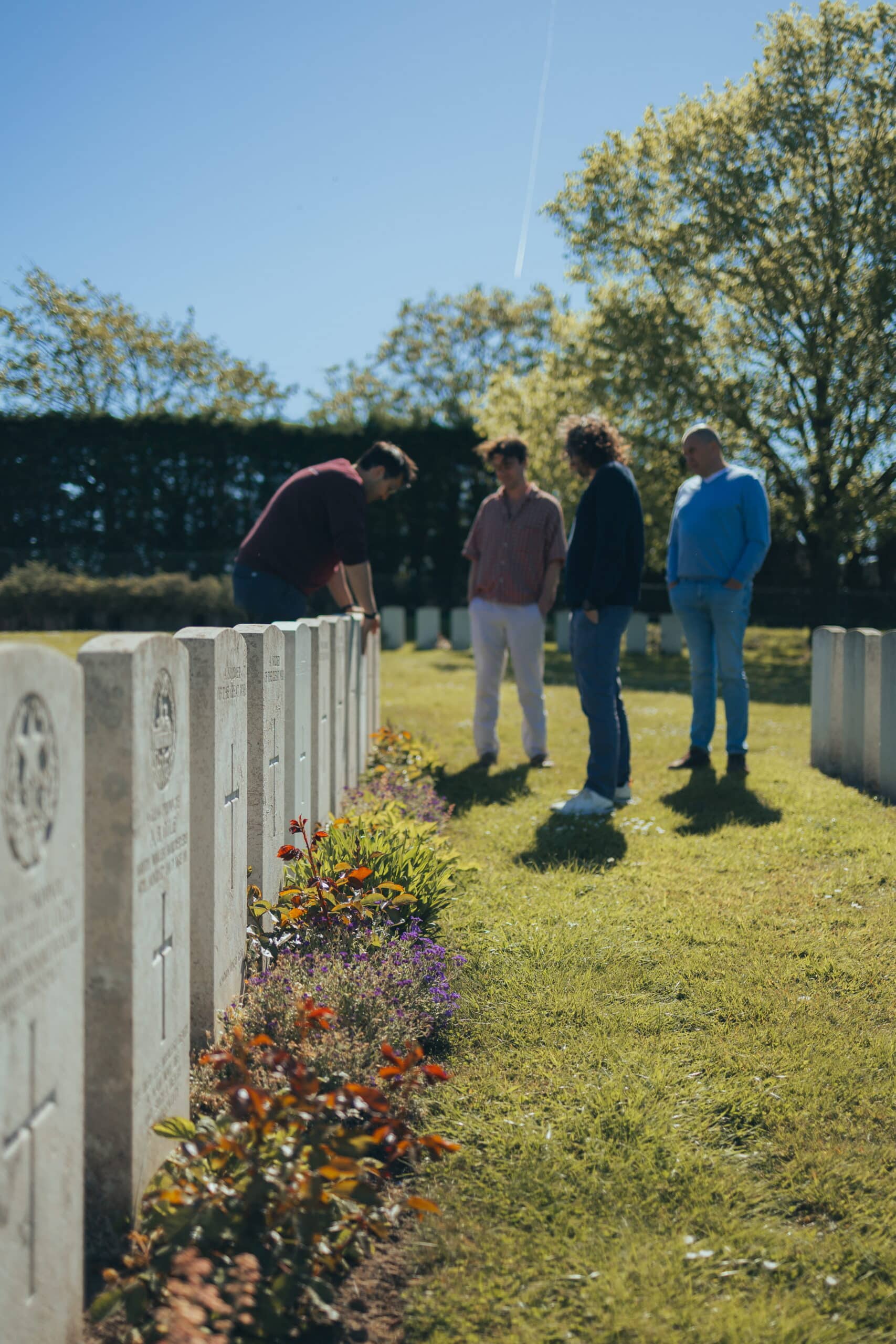
A CWGC cemetery has a visual language. The Cross of Sacrifice, designed by Sir Reginald Blomfield, appears in cemeteries with sufficient numbers of burials and carries a bronze sword. Larger cemeteries also contain the Stone of Remembrance, designed by Sir Edwin Lutyens. Headstones are generally uniform in shape, but they are not anonymous. They can show rank, name, unit, date of death, age where known, religious symbol and a personal inscription chosen by the family.
Rows are not always perfectly aligned. Wartime burial plots can be irregular because men were buried under battlefield conditions. Later concentration plots are usually more ordered. Special memorial headstones can mark men known or believed to be buried in the cemetery although their exact grave is uncertain. Reading the cemetery layout is therefore a way of reading its history.
If you are visiting a relative, find the grave reference before arriving. A reference such as “Plot XX, Row B, Grave 12” is much quicker to locate than searching by eye. For a memorial to the missing, note the panel number. The CWGC database is the best starting point.
Hill 60: why a small rise could cost thousands of lives
Hill 60 is useful because it breaks the stereotype that every battlefield site is a cemetery or monument. The ground itself is the main exhibit. The “hill” was created from spoil excavated during railway construction in the nineteenth century. Its height gave observation over the surrounding sector, making it strategically valuable.
The position changed hands and was mined repeatedly. British attacks in April 1915 used underground charges. German forces counter-attacked and recaptured the position. In 1917 major mines beneath Hill 60 and the nearby Caterpillar were detonated as part of the opening of the Battle of Messines. Today the craters, bunkers and uneven ground make it possible to explain mining warfare while standing on the result.
Polygon Wood: a lesson in how a successful 1917 attack worked
Polygon Wood is particularly important for Australian visitors. On 26 September 1917, the 4th and 5th Australian Divisions attacked as part of a larger British operation. The Australian War Memorial records 5,770 Australian casualties in the battle. The attack used the method associated with Plumer’s limited-objective battles: heavy artillery preparation, a carefully controlled advance behind a barrage and immediate consolidation against German counter-attacks.
The site also helps explain battlefield transformation. The pre-war plantation was largely destroyed. German concrete positions and the high ground of the Butte shaped the fighting. Today Buttes New British Cemetery and the memorials within the wood sit in a landscape replanted after the war. It feels peaceful, but the geometry of the ground is still legible.
Essex Farm: from casualty treatment to remembrance
Essex Farm is associated with John McCrae, but it deserves to be understood as a medical site first. An Advanced Dressing Station operated beside the canal. Wounded men arrived from forward positions, received urgent treatment and were then evacuated farther to the rear if they could be moved. Those who died were buried nearby. CWGC’s current visitor material records 1,206 graves.
The surviving concrete shelters make it easier to explain the chain of evacuation: regimental aid posts near the line, advanced dressing stations, casualty clearing stations and hospitals farther back. This was not modern emergency medicine. Treatment took place under shellfire, with limited blood transfusion capability compared with later wars, constant infection risks and huge surges of casualties after attacks.
McCrae’s poem belongs inside that setting. It was written during an active battle, in a place where death and medical work were immediate. That context is more instructive than treating Essex Farm simply as “the place where the poem was written”.
Preserved trenches: original, reconstructed and restored are not the same thing
Visitors understandably want to “walk original trenches”, but that phrase needs care. A trench left open since 1918 would normally collapse. Many battlefield trench sites are preserved outlines, restored systems or reconstructions based on wartime positions. Some locations do preserve genuine wartime ground and structures, but timber revetments, duckboards and sandbags may be later replacements.
That does not make them historically worthless. The important question is what is original: the location, the earthwork, concrete shelter, mine crater, dugout entrance or reconstructed trench profile. A good visit explains the difference rather than pretending every piece of timber is a century old.
German cemeteries and why they look different
A visit to Langemark German Military Cemetery adds another layer to the story. German military cemeteries in Belgium developed under different political, financial and commemorative circumstances from CWGC sites. Dark stone markers, groups of names and mass graves create a visual contrast, but the difference should not be reduced to “dark German versus white British”.
Post-war concentration, changes in borders, the work of the German war graves organisation and later redesigns all shaped the cemetery. Langemark also became entangled with the myth of youthful German volunteers supposedly advancing singing in 1914, a story later exploited for nationalist purposes. The site therefore speaks not only about wartime death but about how societies remember and reinterpret war.
How much can you realistically see in one day?
A full day is enough for a strong introduction to the Ypres Salient if the route is coherent. Trying to visit every museum and cemetery is not. A useful first day normally combines different types of site: one major cemetery, one memorial to the missing, one preserved battlefield landscape, one 1915 or medical site, and the 1917 ridge. This creates contrast and prevents the day becoming a sequence of headstones without explanation.
For example, Tyne Cot gives scale and Passchendaele context; Polygon Wood adds an Australian battlefield story; Hill 60 explains observation and mining; Essex Farm introduces medicine and poetry; the Menin Gate connects the missing to Ypres itself. A preserved trench or German cemetery can replace one of these depending on interests.
If you have a family connection, the plan should change. A grave, memorial panel or exact battalion position deserves time. The most meaningful visits are often not the most famous places. Standing on a quiet road where one battalion formed up before an attack can be more powerful than adding another large memorial to the list.
Half day or full day?
A half day can work for visitors with limited time, especially if they want a focused introduction around Ypres. It requires choices. You may combine Tyne Cot with one or two other sites, or focus on a family story and finish in Ypres. A full day gives enough time to connect the northern, eastern and southern parts of the Salient without rushing.
The Last Post is at 8pm, so there is often a gap between the end of a daytime battlefield visit and the ceremony. Many visitors use that time for dinner in Ypres or a visit to the town centre. Do not assume the ceremony is a “show” at the end of a tour. It is an act of remembrance organised by local volunteers, and it deserves to be attended on its own terms.
Can you combine Ypres with the Somme or Vimy Ridge in one day?
Technically, you can drive from Ypres to the Somme or Vimy Ridge. That does not mean you should compress them into one sightseeing day. The Somme, Arras and Vimy form a different battlefield region with their own geography, chronology and national stories. A separate day allows time for Beaumont-Hamel, Thiepval, Lochnagar, Pozières or Vimy without spending much of the visit in the vehicle.
If your trip is built around Canadian history, one Ypres day and one Vimy/Somme day creates a much stronger narrative. Australian visitors often benefit from a Ypres day focused on Menin Road, Polygon Wood, Broodseinde and Passchendaele, followed by a Somme day for Pozières, Mouquet Farm, Villers-Bretonneux or Bullecourt. New Zealand visitors can connect Messines and Passchendaele in Flanders with the Somme and 1918 actions farther south.
Family history: start with the record, not the memorial
If you know the name of a soldier, begin with the CWGC record and service file where available. Establish the correct unit, date of death, cemetery or memorial, then work outward. A battalion war diary can tell you where the unit was operating. Brigade and divisional records add context. Trench maps can identify named positions that no longer exist on modern maps.
Be careful with family stories. A relative may have been remembered as “killed at Passchendaele” even if he died at Polygon Wood, Broodseinde or a casualty clearing station miles behind the line. Families often used the best-known battle name. The official record can refine the story without diminishing the family memory.
If a soldier has no known grave, that does not mean nothing can be found. A memorial panel is only the end point of commemoration. Unit records, casualty reports, maps and contemporary accounts can sometimes narrow the likely location of death to a surprisingly small area.
What should you look for in the landscape?
The modern battlefield rewards slow observation. Look at road levels, drainage ditches and the direction of ridges. Ask which side could see which road. Notice where cemeteries cluster. Many stand near former dressing stations or battlefield burial grounds. Concrete bunkers are often easier to spot once crops are low. Church towers help orient the old front lines.
Do not enter fields without permission. Much of the battlefield is private farmland and unexploded ordnance is still recovered. The annual “iron harvest” is not folklore. Farmers continue to encounter shells and other wartime material. Stay on public paths and established sites.
What makes a good first Flanders Fields visit?
The best visit leaves you with a mental map. You should be able to stand in Ypres and picture where Passchendaele lies, understand why the ridges mattered, distinguish a cemetery from a memorial to the missing, and recognise that the war here changed repeatedly from 1914 to 1918.
It should also leave room for individual people. The statistics around Ypres are almost impossible to absorb. A single grave inscription, a father and son on the same memorial panel, a teenage soldier, a doctor writing after the death of a friend, or a battalion trying to follow a barrage through shell-torn ground makes the scale human again.
Frequently asked questions
What are the main WW1 sites in Flanders Fields?
For a first visit, the strongest combination is Tyne Cot Cemetery, the Menin Gate, Hill 60, Passchendaele or Polygon Wood, Essex Farm and one preserved trench or bunker site. The exact choice should depend on your interests and any family connection.
How many days do you need for the Ypres battlefields?
One full day gives a strong introduction to the Ypres Salient. Two days allow more museums, family-history stops and lesser-known battlefield sectors. The Somme and Vimy Ridge are best treated as separate days.
Can you visit Flanders Fields without a guide?
Yes. The major cemeteries and memorials are open to independent visitors. A guide is most useful for connecting the landscape, battle chronology, unit movements and family-history records that are difficult to interpret from the roadside.
What is the difference between Flanders Fields and the Ypres Salient?
Flanders Fields is a broad modern term for the First World War landscape in Belgian Flanders. The Ypres Salient is the specific bulge in the Allied front line that surrounded Ypres and was fought over from 1914 to 1918.
Is Passchendaele close to Ypres?
Yes. Passendale is only a short drive east of Ypres, but in 1917 the distance was crossed through heavily defended ridges, artillery zones and devastated ground. The short modern distance can be misleading.
How many days do you need to see the WW1 battlefields of Flanders Fields properly?
A single full day is enough to see the core Ypres Salient sites properly with a private guide, Tyne Cot, Hill 60, Passchendaele and the Menin Gate. If you also want to include the Somme or Vimy Ridge, plan for two separate days, since the two regions are about two hours apart by road.
Can you visit Flanders Fields and the Somme in one trip?
Yes, many visitors combine both regions, usually as two separate day tours rather than one long day, since Flanders Fields and the Somme are roughly two hours apart. A private guide can help plan the order and timing so both regions get the time they deserve.
Is it possible to visit the WW1 battlefields without a car?
No. Most battlefield sites around Ypres are spread across farmland and villages with limited public transport, so a private guided tour with pickup from Bruges or Ypres is the easiest way to see them properly without renting a car or relying on local buses.
What is the best time of year to visit Flanders Fields and the Ypres Salient?
Flanders Fields can be visited year round. Spring and summer offer longer days and easier walking conditions, while autumn and Remembrance related dates in November carry extra weight at the cemeteries and the Menin Gate. Winter visits are quieter and still meaningful, just colder underfoot.
Do you need to book a guide in advance to visit Tyne Cot and the Menin Gate?
Tyne Cot and the Menin Gate are both open to the public without a guide. A private guide is not required to enter, but adds context, soldier stories and a structured route connecting these sites to the wider battlefield, which is difficult to piece together alone.
Historical details on this page were reviewed against current Commonwealth War Graves Commission material and other relevant official or national collections. Visitor information can change, so check the linked site or memorial authority if you are planning around a special ceremony or closure.

Private Ypres Battlefield Tour
See the Ypres Salient as one connected battlefield story rather than a checklist of monuments. A full day gives time to understand the ridges, cemeteries, memorials and personal stories without rushing.
Private tour for your own group. Current seasonal price and availability are shown on the booking page.
Check AvailabilityWritten and reviewed by Niels Declercq, private WW1 battlefield guide based in Bruges.